3 Marin County Hikes You'll Love Taking in Northern California
Today I want to bring you my guide to the best Marin County hikes in California. If you love getting out on the trails as much as you enjoy the San Francisco Bay Area's beautiful scenery and panoramic views, this list will show you some of the top places to go hiking in the North Bay. From Tennessee Valley to Mount Tamalpais, waterfall hikes to Pacific Ocean trails, it covers a variety of locations and terrain. I've included a map, too.

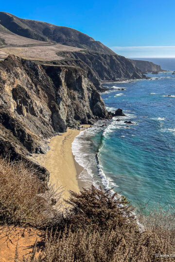
Marin County Hikes
Given how much San Francisco Bay Area residents love getting outdoors, there are lots of fun hikes in Marin County. Whether you want to hike by the beach, in the hills, up a mountain, or with your dog, you're spoiled for choice when it comes to trails in this part of Northern California.
I've been hiking in the Bay Area since I was a child. Having grown up on the Peninsula, I walked many of the trails in this part of the Golden State with my family and friends when I was growing up. I still love getting out on the paths, and I've enjoyed doing some of the best hikes in Marin County as an adult.
From the Marin Headlands to Mount Tam, I've trekked a lot. My routes have covered everything from easy coastal walks to challenging vertical ascents. This list has my favorites, and I hope you enjoy them as much as I have.
I'll add more hikes to this blog post as I write about them, so you can bookmark it or pin it on Pinterest for easy reference. Given how much I love hitting the trails, I know I'll be publishing another one soon.

Tips for Hiking in Marin County
As with all Northern California hikes, make sure to bring plenty of water, wear good shoes, and dress in layers. The weather can change quickly, especially in coastal areas where fog is known to roll in without notice.
If you're going on a longer hike, remember to bring snacks and pack out your litter, too. Carrying a good backpack can help you organize your extra clothing, water, food, and waste bags.
Don't forget to stick to the trails (especially if there's poison oak around), and check yourself for ticks at the end. Ticks are common in the plants that line the paths in the San Francisco Bay Area, and they can cause Lyme disease.

1. Cataract Falls Hike
First on my list of the best Marin County hikes is the Cataract Falls trail. This waterfall hike is a popular place to hit the hills in the Bay Area after heavy rain or a big storm. It's dog-friendly, too, which is a bonus for many local residents.
Right off the Fairfax-Bolinas Road near Stinson Beach, this hike is located in the Mount Tamalpais Watershed. It's a protected mountain area, and it's known for its redwoods, streams, and reservoir.
Cataract Falls is one of the most famous waterfall hikes in Marin County (and the entire San Francisco Bay Area, for that matter). It features a narrow woodland path that hugs a series of falls cascading down Cataract Creek. Seeing waterfalls the whole way is one of the best things about this route.

A moderately challenging trail, the Cataract Falls route involves hiking up uneven stone stairs and across skinny footbridges. There's a decent amount of elevation gain on the way up, too.
The Cataract Falls trail can be done as an out-and-back hike or a loop. The former is around 3 miles on the Cataract Trail (1.5 miles each way). It involves an elevation gain of around 1,055 feet.
The loop trail is around 7.5 miles on a number of different paths. It entails an elevation gain of around 1,985 feet. You can see a map of both routes on my blog post about the Cataract Falls hike for further details.

The amount of time the hike takes depends on your fitness level and how fast you walk. The 3-mile hike takes around 2 to 3 hours, and the 7.5-mile loop trail takes around 3.5 to 5 hours. If you're in great shape, you can do it faster. If you take your time and stop frequently, it could take longer.
You can do this hike year-round, but because the waterfalls are the main attraction, it's best to do it after heavy rain. In Marin County's case, that's usually winter. If you time your trek to coincide with a break in stormy weather, you'll get to see the falls at their fullest.

2. Oakwood Valley Trail
Next on my list of the best Marin County hikes is the Oakwood Valley Trail. It's located just north of the Marin Headlands, and it's home to the largest stand of oak and bay forest in the Golden Gate National Parks. Over 500 plant species grow here, and the area features a grassland and mixed woodland habitat.
This is a moderately challenging hike, and it's a fun one to do if you like wooded areas and a view at the end. It's dog-friendly, too, so you can bring your pup if you want to.
The trail isn't as steep as some of the others in the Golden Gate National Recreation Area, so it’s a great option if you want to go for a relatively easy walk in the woods.

The Oakwood Valley Trail is 2.58 miles round-trip. It’s fairly flat at the start and end, and it has an optional hilly section in the middle with a decent amount of stairs to climb.
That's because the hike is part loop trail and part out-and-back path. It starts on the single-track Oakwood Meadow Trail before it meets the Oakwood Valley Trail (sometimes called the Fire Road Trail). From there it goes all the way up to where it meets the Alta Trail.
When you get to the intersection with the Alta Trail, you can turn around and retrace your steps to where the Oakwood Valley Trail meets the Oakwood Meadow Trail, then hike back to the parking area via the fire road.

The Oakwood Valley Trail meets Tennessee Valley Road right near where the Oakwood Meadow Trail does, so you only have to walk a short distance to get back to your car once you reach the road at the end.
This Marin County hike starts at an elevation of 33 feet. The trail ascends to an elevation of 621 feet at its apex. Most of the gain happens on the out-and-back section in the middle, so you can skip that part and just do the loop trail if you want a flatter walk.
The Oakwood Valley Trail is well-maintained and well-signposted, so it’s simple to follow. The path is wide in most places, so there’s room for groups if you want to do the hike with a larger party. You can see the full route and map on my blog post about the Oakwood Valley Trail.

3. Olompali State Historic Park Hike
Next on my list of the best Marin County hikes is Olompali State Historic Park. Just off Highway 101 in Novato, this under-the-radar spot has a lot of history, including connections to everything from the Bear Flag Revolt to the Coast Miwok and the Grateful Dead. The oldest surviving house north of the San Francisco Bay is located here, too.
Olompali is a 700-acre California State Park on land that was once the Rancho Olompali. Hiking trails crisscross the grounds, and they’re great places to get into nature and see this unique part of the Bay Area. There are stunning views of the Petaluma River and San Pablo Bay from the paths leading up to Mount Burdell, too.
The 2.4-mile Miwok Loop Trail will take you up the lower hillside of Mount Burdell. It's a moderately challenging hike that will lead you past a recreated Coast Miwok Village, into wooded areas full of oak trees and wildflowers, and along trails offering peek-a-boo glimpses of San Pablo Bay. You might spot grazing deer as you go, too.

This hike takes just under 2 hours. You can do it as a day hike, or combine it with a trip north to Napa or Sonoma.
If you’re looking for something more challenging, you can do the 9-mile loop trail to the peak, which reaches an altitude of 1,558 feet. You can learn more about both routes and see a map on my blog post about Olompali State Park hikes.
You can do these hikes any time of year, but this area gets hot in the summer. I recommend doing it outside the warmer months or going in the morning to avoid peak temperatures.

Map of Marin County Hikes
As promised, you can see a map of all the hikes on my list here. If you click on the pins, you'll find my blog posts about each one. I hope it helps you find your favorite hikes to do in Marin County.

Marin County Hikes
I hope you've enjoyed this guide to the best hikes in Marin County. There are lots of great trails for you to discover in this part of Northern California, and I'm sure you'll enjoy them as much as I have.
If you want to learn more, you can watch my YouTube videos about the Cataract Falls hike and the Oakwood Valley trail. They'll show you the routes and give you more detail about what the paths are like.
I've also done fun hikes in the Marin Headlands, up Mount Tam, and on the Bolinas Ridge Trail. They're great ones to do, too. And if you want inspiration for paths further afield, you can take a look at my blog post with all the hiking trails in the Bay Area I've written about. Happy trekking!
Find this helpful? Buy me a coffee!
Some of the links in this blog post are affiliate links. At no cost to you, I earn a small commission when you click on them and make a purchase. It doesn't affect the way you shop, and it's a great way to support the California Wayfaring blog.
Pin it!